


GPS directing drivers onto rural roads
With the advent of GPS navigation, drivers are being directed onto municipal roads that may not be designed to accommodate the volume or speed of traffic so a ‘workaround’ is being explored until a more permanent solution is found.
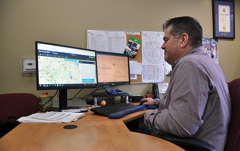
Deputy director of public works Dan Perrault said it is known that there is a significant amount of traffic coming through Clearview on the way to other destinations, like Wasaga Beach and Blue Mountains. The municipality is just now getting a handle on exactly how much traffic is on specific roads. Existing radar signs, with more on order, are providing a baseline measurement of traffic volume and speed so that staff will be able to say if indeed certain roads are problematic.
There are examples though of people trying to take rural roads that are not ploughed in the winter, and Perrault has heard from residents that traffic is becoming an issue on Concession 10 North Nottawasaga, near Duntroon, because of GPS wayfinding.
He is hopeful that the use of software that interfaces with mapping apps like Waze and Google will help travellers find more appropriate routes.
The municipality is a user of Municipal 511, which logs road conditions and closures due to construction and weather, for the benefit of the travelling public.
He said, it is meant to create alerts during road closures or traffic reductions due to major snowstorms, fires, and construction for example. Although not the primary use of the service, Perrault said he can put restrictions on certain roads. He said the “work around” allows him to flag roads that are summer maintenance only or are in other ways not built to accommodate large volumes of traffic.
“That is supposed to blast out to GPS providers to show Waze and other apps that there is construction or a road is closed,” said Perrault.
For example, he was able to label a portion of the Mulmur-Nottawasaga Townline as a no-winter maintenance road, and at the end of January Concession 10 was labelled “road unsuitable for through traffic in the winter” to address residents’ concerns.
Perrault said it is frustrating because depending on the search, the results can differ. For example, if someone coming from the south searches Blue Mountain Resort using Google Maps, the route will direct them onto Concession 10 but if they search up Town of the Blue Mountains or Collingwood, it will direct them to stay on County Rd. 124. However, Concession 10 no longer shows up on Waze.
“People coming from the Orangeville area or Mississauga or whatever, they punch in Blue Mountain and it takes them up to 124 and then across. The shortest route, even if it’s a minute shorter, people usually tend to take that and it scoots them up the 10th Concession, well that’s when we get in trouble. It’s not as high of class road as a county road,” said Perrault.
“The county has more resources for ploughs and that type of thing. If they were to stay on 124, it may take them an extra minute but they’re not going to have the headache of going through those difficult hilly conditions, more snow, and gravel roads, things like that.”
Locals may know to stick to the main roads when conditions are bad but visitors are often choosing a route without fully understanding where their GPS is taking them.
Perrault said there is a push for municipalities to be able to indicate a preferred route through their boundaries, depending on where they are heading. The issue was initially raised by small communities along the 401 corridor that were unable to handle the influx of traffic when there was an emergency road closure and is now on the radar of the Good Roads Association.
In the meantime, Perrault said, signs are being installed to try to encourage people to stay on main roads. Concession 10 is scheduled for upgrades, he warns, so that may not help.
